

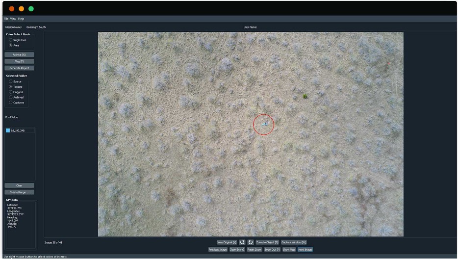
Loc8 is a software produced by USR – “Unmanned Systems Research” and used in search and rescue that allows you to quickly scan images from drones to locate people or objects using advanced image scanning technology that isolates specific clusters of pixels. Once you identify the potential targets and the user confirms the target, generate a map and an aerial view of the location of the specified target.
Loc8 is the perfect tool for applications such as :
- Public safety and emergency first responders
- Inspections of public service infrastructure
- Civil air patrol (search and rescue)
- Industrial and environmental applications
- ADVANCED DETECTION WITH COLOR BANDS
You can enter specific color ranges to quickly spot hard-to-see pixels on images scanned and processed by Loc8.
- COORDINATE GPS PRECISE
Get detailed and accurate GPS coordinates of the reported objects to perform a quick recovery or rescue.
- DETAILED QUALITY REPORTS
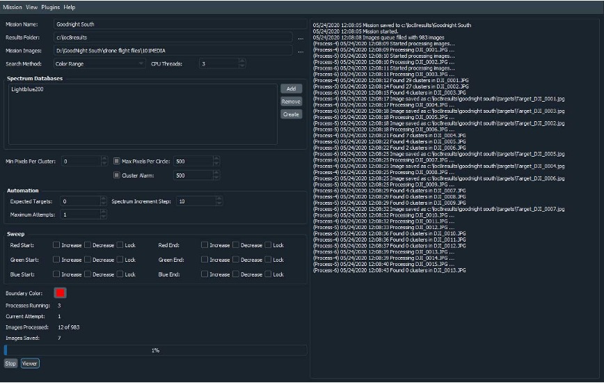
Generate detailed reports on the quality and output matches of scanned images to identify flagged images quickly.
- FAST IMAGE PROCESSING
Regardless of the source of the digital images: smartphones or cameras mounted on drones or laptops. It works on Windows and Mac operating systems, even offline.
- IMPORT MISSION IMAGES
Import images from your device to Loc8 and save mission results to your computer for storage and easy access.
- SCAN MULTIPLE OBJECTS
Add and create multiple spectra databases to search for multiple objects or clusters of pixels at once.