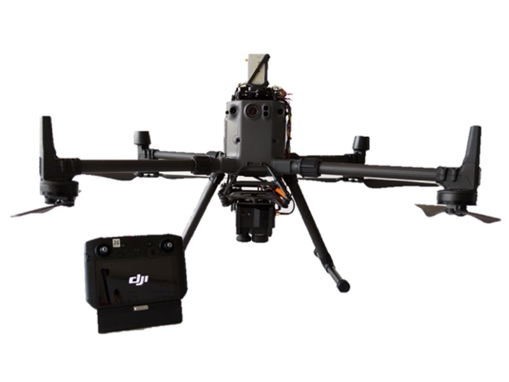

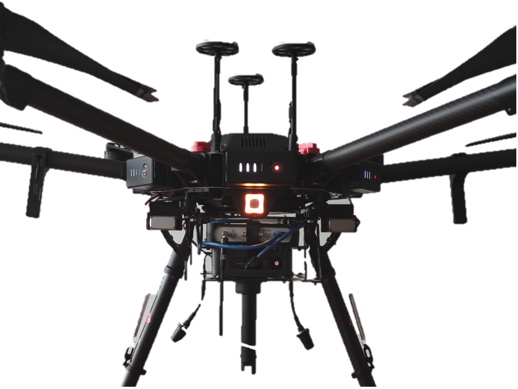
The integrated systems for drones represent the real added value of Aermatica3D; the research and development department is not limited to creating customized drones, but based on the specific requirements of each customer can develop and integrate kits, cameras, and sensors, allowing to have a single integrated remote-sensing system for remote control of the device and the visualization and management of data in real-time on the ground, thus obtaining a safe, complete and reliable product.
To meet the particular operational needs, Aermatica3D has also developed the BLY3D app, a fully customizable software capable of performing automatic flight missions even in complex scenarios, allowing you to plan and manage any payload in a simple, easy and precise way and integrated by us.
Aermatica3D can offer custom solutions for any integration thanks to its know-how in the engineering field and the cooperation with official partners from international realities. As a result, Aermatica3D offers its customers the best technologies in the payload field, perfectly integrating chambers, kits, and sensors
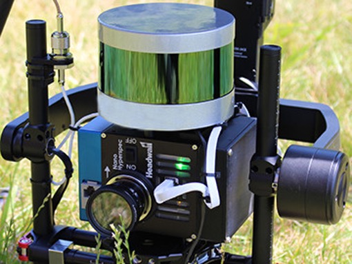
DRONE-HYPERSPECTRAL SENSOR INTEGRATION
Nano Hyperspec ® Hyperspectral Chamber Sensor Integration by Headwall Photonics Inc
Technical features
- Simplified data acquisition thanks to a perfect integration between Multisensor and Drone
- Camera with 150 sensors for hyperspectral detections
- Simplified capture of collected data
- Visualization of data collected in Real-Time directly on the Flight Controller
The integration developed by Aermatica3D allows you to manage the Headwall Photonics Nano Hypersec hyperspectral sensor directly from the flight controller being able to count on the most simplified and reliable data acquisition thanks to complete integration between hyperspectral sensor and drone.
The camera onboard communicates through special hardware directly with the BLY3D software to monitor and fully manage the sensor, allowing you to plan a single flight plan on the software with the ability to change the parameters of the camera directly from the drone console and to monitor how the acquisition of data is evolving in real-time.
GROUND KIT FOR HYPERSPECTRAL ACQUISITION
Ground Acquisition Kit with Hyperspectral Camera Sensor
(Nano Hyperspec ® ) by Headwall Photonics Inc.
Specifications
- Simplify the data acquisition process with precise horizontal or vertical scans;
- Visualization of the data collected in Real-Time directly on a Tablet for the calibration and setup of the camera;
- Change the camera parameters directly from the console;
- Acquisition of hyperspectral data without the clutter of cables and computers, but remotely with the wireless connection of the tablet
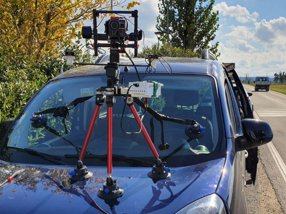
The product allows you to use the camera on a tripod or a car according to your needs. In addition, it will enable you to use the hyperspectral sensor directly from the Flight Controller, thus being able to count on the most simplified and reliable data acquisition.
The operations that previously required a laptop physically connected to the camera before take-off are now entirely managed by the app. All the camera commands that have been coded and implemented directly in the BLY3D application developed Aermatica3D.
The Kit from the ground for hyperspectral acquisition allows an extreme simplification of the operation also in terms of security on the acquisition of data; from the app, it is possible to know if the camera is working during the flight, in what state it is, if the GPS is acquired and can stop the acquisition of data at the last waypoint of the flight without having to approach the camera to connect and give the stop physically.
DRONE-MULTISENSOR INTEGRATION
Air quality multi-sensor integration for chemical-physical parameters detection
- It simplifies the data acquisition process thanks to a perfect integration between Multisensor and Drone.
- Certain acquisition of the collected data
- Multilayer functionality to carry out three-dimensional flight plans thanks to the BLY3D app;
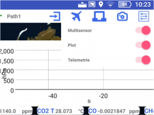
- Visualization of data collected in Real-Time directly on the Flight Controller
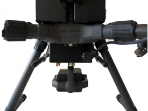
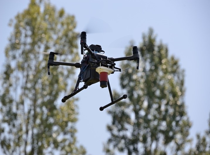
The solution consists of a single remote-sensing system consisting of a drone of the DJI Enterprise Matrice 300 RTK series, associated with a multispectral sensor capable of recording data relating to humidity, pressure, temperature, and gases such as carbon dioxide, carbon monoxide, methane, and hydrogen sulfide also recording the temperatures of the individual gases detected.
The Multilayer functionality of the BLY3D app allows you to plan three-dimensional flight missions to study the concentration of the parameters as a function of the height of the data and display them in real-time individually or on graphs for a complete and rapid understanding of each data collected during the flight.
DRONE-RADIATION SENSOR INTEGRATION
Radiation sensor integration
Specifications
- X, alpha, beta, and Gamma Radiation Sensor
- Secure acquisition of the collected data
- Software integration with BLY3D apps
- Digital soil models for precision agriculture
- Detection of contamination and radioactivity levels with related spectral signatures.
Aermatica3D has integrated onboard UAV systems, the equipment made available by INFN for high-resolution X, alpha, beta, and gamma spectroscopy for the analysis of radioactive elements and ultra-trace elements in soils, as well as advanced electronics developed in the ANTARES, REDCAT DEVICES, and BLUELECTRONIC design laboratories for the development and integration of electronic and optoelectronic units.
Efficacy detection device for precision farming, identification of compensation areas, detection of contamination, verification of radioactivity levels, generation of digital models of soil and vegetation cover.
In addition, the product is also indicated for the study of the state of health of vegetation, mapping the consequences of forest fires, evaluating the effectiveness of ecological restoration interventions, and identifying territorial peculiarities to enhance agricultural products.
DRONE-MAGNETOMETER INTEGRATION
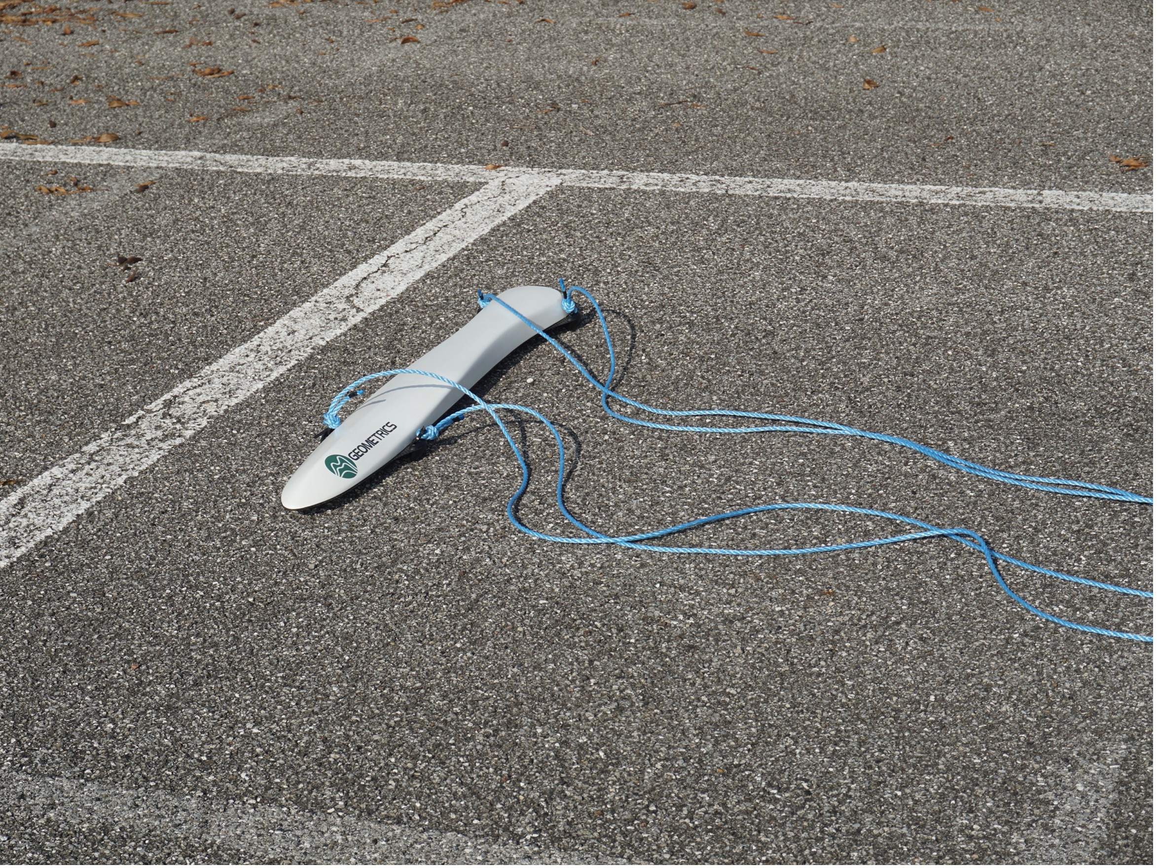
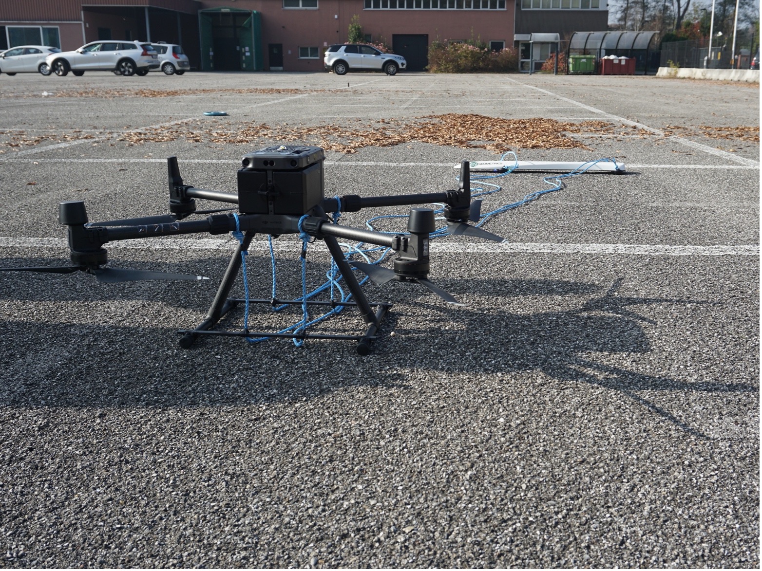
MagArrow Magnetometer by Geometrics for geophysical data surveying
- Lightweight: It weighs only 1kg, allowing 20% longer flight time on a 2.5kg payload drone.
- Standalone solution: GPS, storage, and WiFi onboard.
- Fast sampling rate: flies faster, up to 10 m/s, with samples every 1 cm. Filter the noise of the UAV engine.
- Real-Time Data: View data in the field using any device.
- Low Power: A single 1800 mAh lithium polymer battery will power the system for 2 hours, outlasting multiple UAV flights. Batteries are hot-swappable.
Designed to simplify investigations in complex scenarios, the MagArrow is the magnetometer for magnetic surveys with drones, a robust and flexible system that can adapt to changing field conditions and user workflows.
The MagArrow consists of an aerodynamic and lightweight carbon fiber shell with internal electronics, including MFAM™, GPS, and IMU magnetic sensors. MFAM™ is geometrics’ magnetometer composed of a two-sensor module inside the MagArrow, capable of measuring precisely and in a highly light and compact format.
The operation in the field is simple; the surveys are programmed by the UAS software chosen by the user. The flight programmed via GPS waypoint allows you to transport the MagArrow with stable detection lines. MagArrow can be easily connected to a wide variety of business drones and possesses a high sampling rate; surveys can be completed at speeds of up to 10 m/s with samples collected every 1 cm.
MISEC – Multifunctional Integrated Sensor and Embedded Controller
Drone-embedded controller integration for directional radio frequency sensor
Integration Kit on DJI Matrice 600 PRO:
- Integrated Senso – Directional antenna for radio frequency analysis
- Onboard PC – for data collection and analysis.
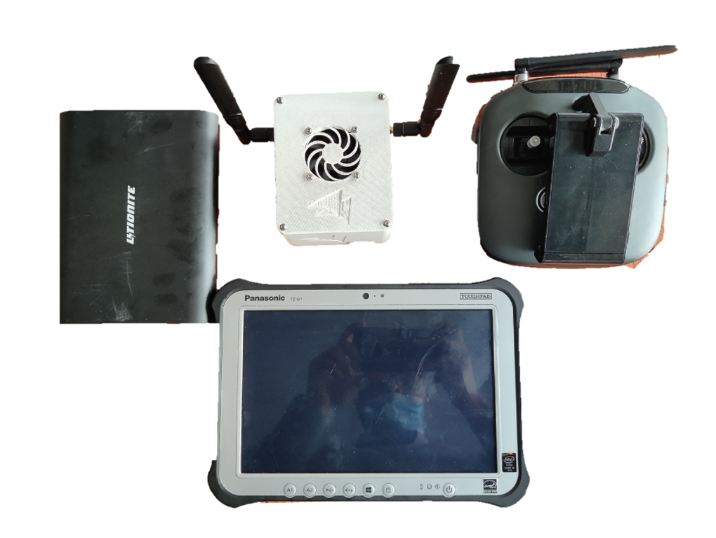
- Data Link Bridge – to access the instrument in flight from a laptop positioned on the ground.
- Real-Time Data – displays radio frequency processing on the tablet up to 500 m away.
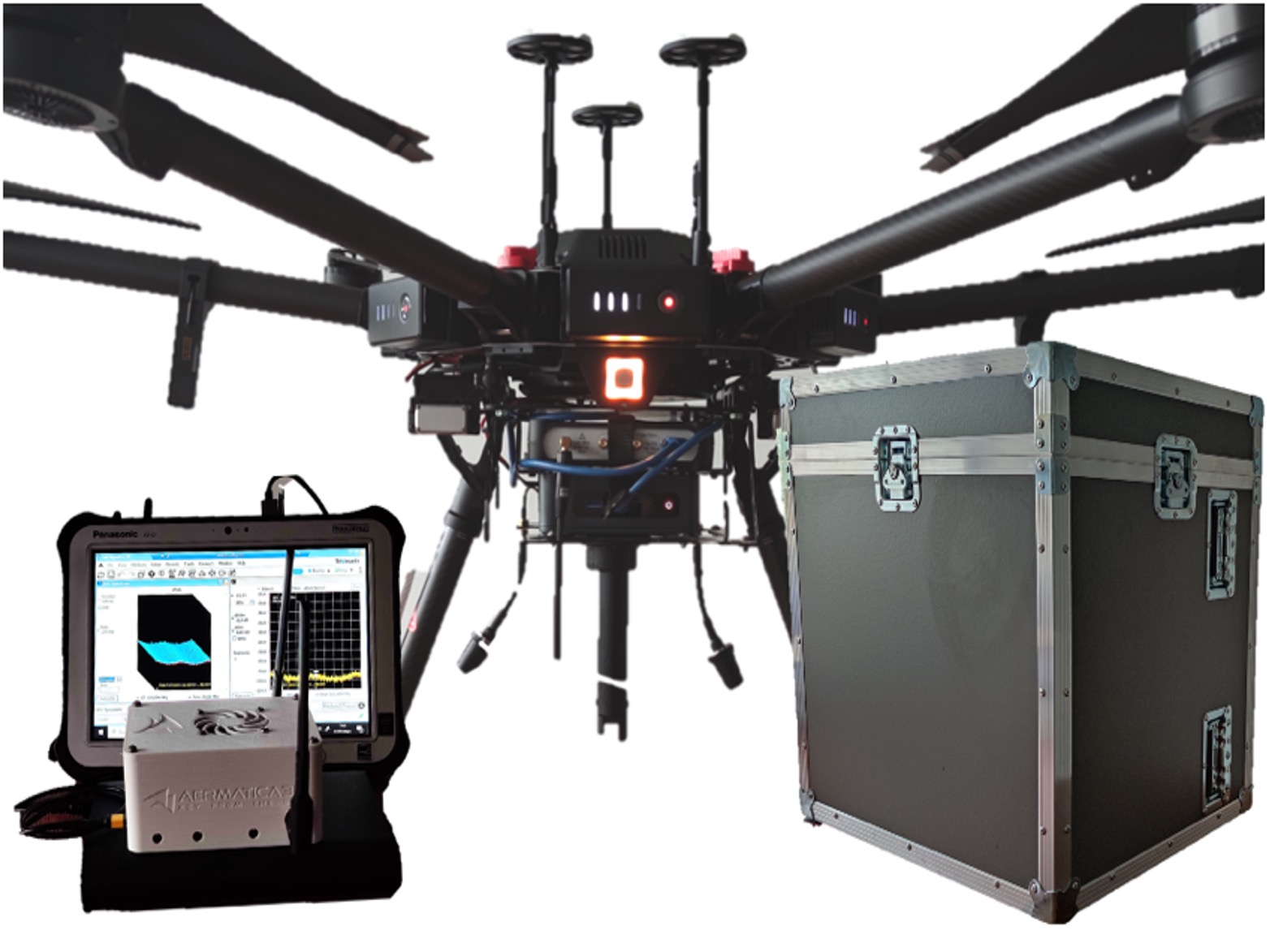
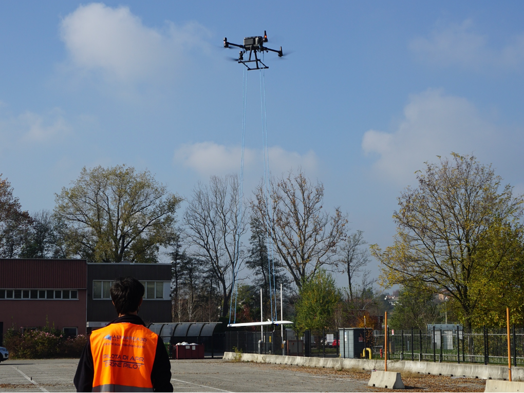
MISEC, an acronym for Multifunctional Integrated Sensor and Embedded Controller, is an integration designed by Aermatica3D to simplify the acquisition and analysis of radio frequencies by displaying the data acquired in real-time on the ground. The integration is based on an onboard PC to manage the onboard software and analyze the collected data.
The system is also equipped with an integrated sensor, a directional antenna to analyze the spectrum of electromagnetic fields used to identify and verify compliance with radiofrequency emissions.
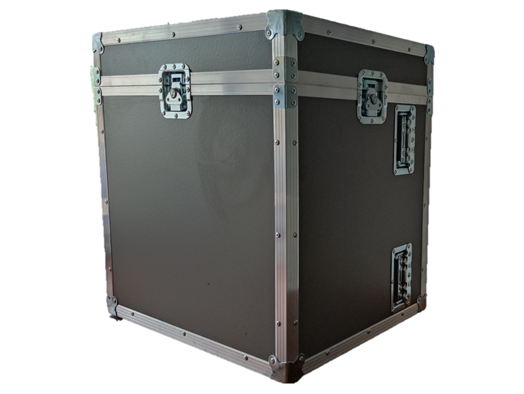
MISEC is easy to use; you just need to turn on the drone and the PC on board and put in communication PC and tablet to view on your tablet the data that will be acquired by the sensor integrated on the drone. The solution also includes a transport case tailored to allow easy transport of the drone, instruments, and components.
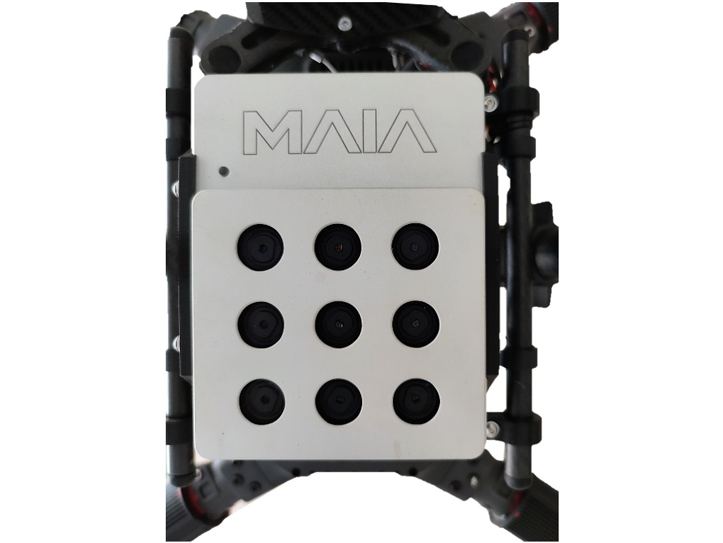
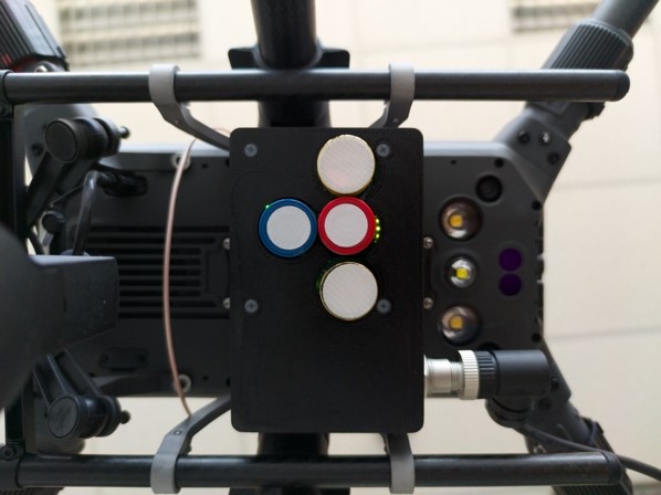
MAIA MULTISENSOR AND FLIR THERMAL CAMERA INTEGRATION
Integration on UAV systems of MAIA multisensor for the detection of environmental data
MAIA S2 is a multisensor camera designed to be used onboard UAV systems and finds numerous applications for:
- Precision farming
- The classification of crops
- The classification of materials on the ground
- Environmental monitoring,
- Monitoring of landfills.
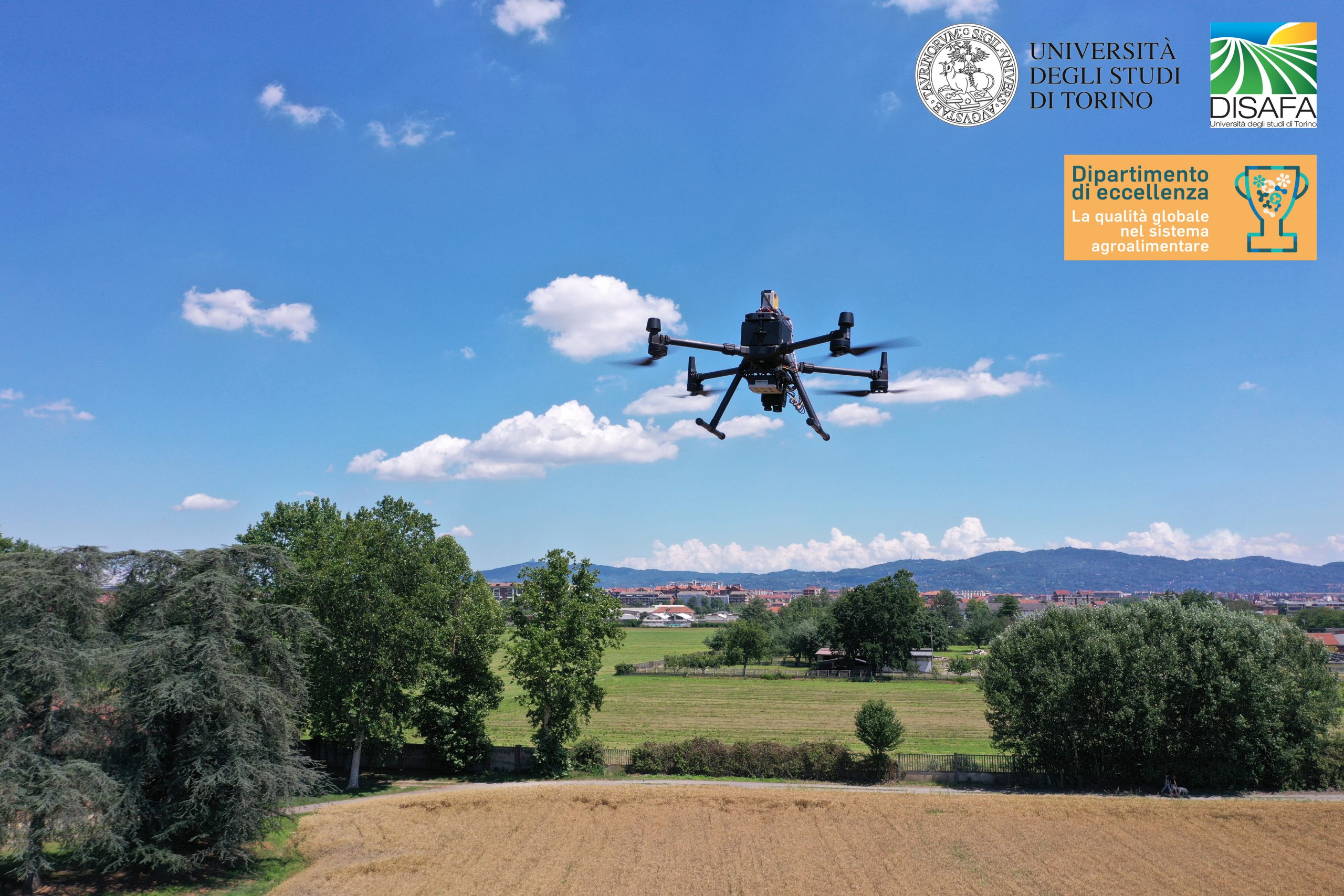
Aermatica3D has developed an integration for the University of Turin between DJI Matrice 300 RTK drone with the MAIA S2 multispectral camera and the FLIR DUO Pro R 640 thermal chamber. MAIA S2 is a multispectral camera designed to be used onboard UAV systems, entirely made in Italy. MAIA S2 is based on a series of 9 1.2 Mpixel sensors (9 monochromes with related band-pass filters) to analyze the VIS-NIR spectrum at the same wavelength ranges as ESA’s Sentinel-2™ satellite, from 433 nm to 899.5 nm.