

Agritech: Environmental benefits as results of the PIGNOLETTO project’s analyses
PIGNOLETTO, a project in which Aermatica3D participated last year, concluded its activities on 30 November 2022, fine-tuning the various detection tools and the IT platform necessary to process the collected data. The analyses of the project gave positive results in terms of environmental benefits. PIGNOLETTO now proposes itself as the basis of a technological HUB, with international projection, in the field of development and use of land monitoring systems using proximal or remote sensing devices.
A mix of different sensors, whose data is collected in an IT platform to ‘trace’ the exact composition of agricultural land in a faster and more economical way, allowing for water and fertilizer savings.
This is the solution to effectively enable precision agriculture in Lombardy developed by PIGNOLETTO, one of the 33 winning projects of the Call Hub Research and Innovation call of the Lombardy Region, in Northern Italy, coordinated by the National Institute of Nuclear Physics – INFN supported by five Departments of the University of Milan Bicocca (Environmental Sciences, Physics, Computer Science, Materials Science, Biotechnology), and in collaboration with Aermatica3D for the aerospace sector and drones solutions for surveys together with numerous other leading companies operating in the sensor and agri-environmental sector. The project was successfully completed, producing interesting results.
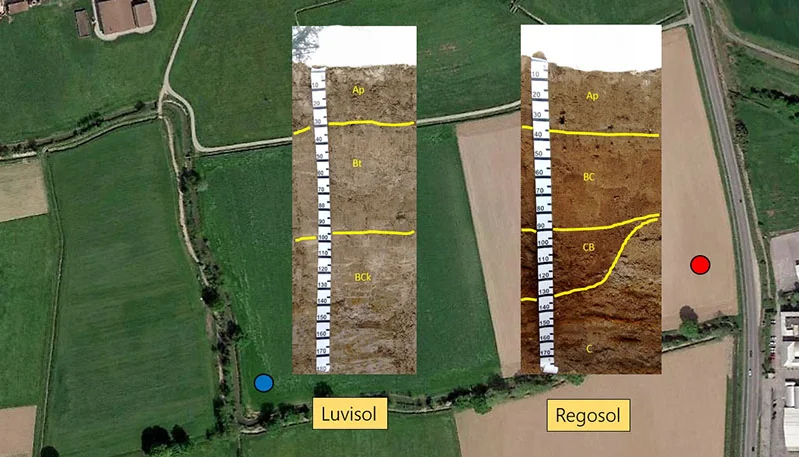
“The soil is often treated as if it were homogeneous”, explains Professor Comolli, project coordinator and associate professor of pedology at the Bicocca Department of Environmental and Earth Sciences. “PIGNOLETTO’s goal was to develop a data collection and validation system to allow us to know precise information about the physical and chemical composition of the soils.”
Today, analyzes of this type are in fact out of the reach of farmers: to ‘map’ a few hectares in great detail, hundreds of samplings would be necessary, with very long times to obtain and with absolutely prohibitive results and costs.
The Innovation
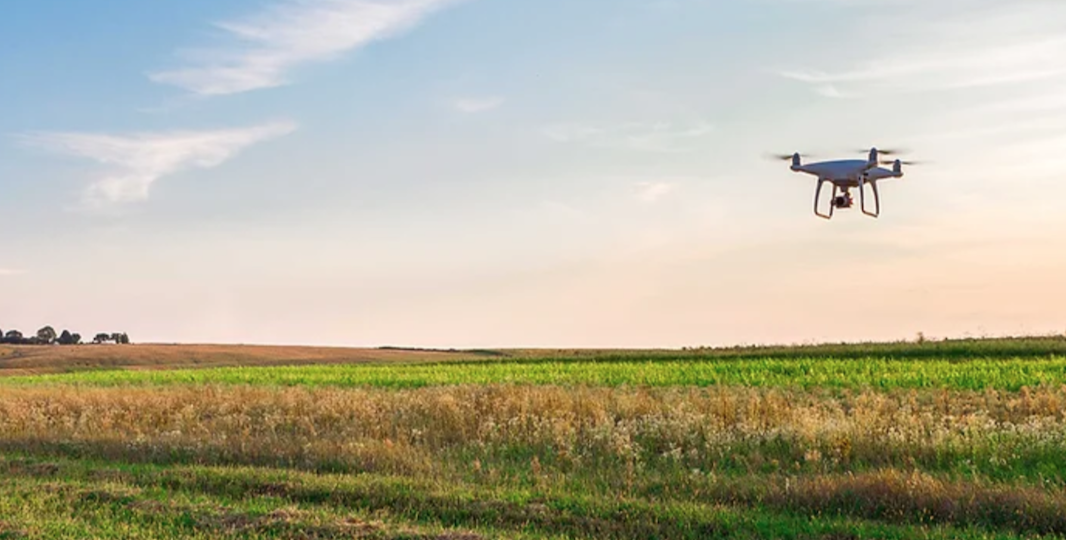
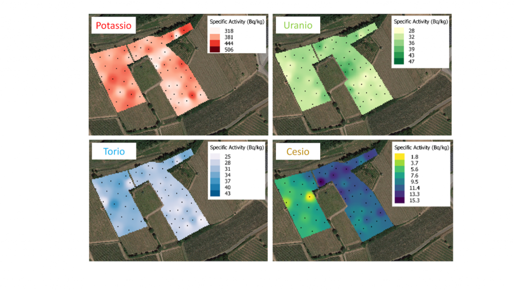
The PIGNOLETTO project combines different forms of detection: electromagnetic and geoelectric field measurements using sensors mounted on quads, measurements obtained from sensors mounted on drones (ionizing radiation of the gamma type, optical hyperspectral, thermal multispectral), satellite information (PRISMA and Copernicus) and proximity surveys.
Different data, which once processed, transformed into maps of the soil characteristics and finally uploaded to the platform created by PIGNOLETTO, give farmers a rich and articulated picture of the physical and chemical composition of the soil.
The Advantages
Knowing the characteristics of the soil, as well as knowing the hydraulic conductivity and having an overview of the nutrients present, allows farmers to dose the water and fertilizers according to the real composition of the soil, and therefore save in terms of costs.
The benefits are above all environmental due to the lower use of chemicals and water resources, which are increasingly precious given the looming drought forecast for this summer.
PIGNOLETTO’s analyses finally make concrete the approach to agriculture of the future: precision agriculture. To date, in fact, only very few companies in Italy provide accurate maps of the terrains. Unlike PIGNOLETTO, these maps are all based on a single type of sensor, therefore with a different degree of reliability.
To learn more about it, visit PIGNOLETTO project site