

When choosing to implement a drone within your company, one of the first steps is often to choose the right mapping software, which will help speed up the processing of a large amount of data to reach the best and more informed decision in the shortest time possible. And more informed in the shortest time possible. DJI Terra software is designed to be used by all operators in an industrial process, from initial data acquisition to execution of flight plans, allowing users to import data quickly and efficiently from any supported DJI payload, elaborating 2D orthomosaics and 3D realistic models.
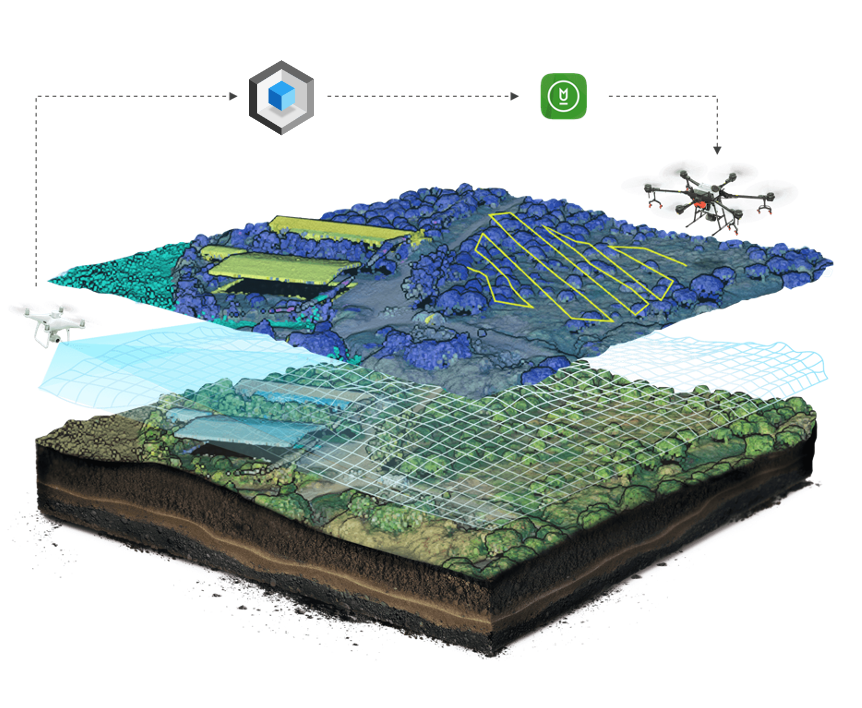
DJI Terra software is an all-in-one solution for mapping, modeling, processing, and data analysis, capable of digitizing data from any application scenario to carry out analysis and flight missions, guaranteeing extreme practicality, efficiency, and precision.
DJI Terra represents the best choice, capable of providing solutions that facilitate decision-making in critical sectors such as public safety, construction, infrastructure, and agriculture.
DJI Terra is used:
- to plan and execute flights for Phantom 4 RTK; Phantom 4 Pro V2.0; Phantom 4 Pro + V2.0; Phantom 4 Pro; Phantom 4 Advanced and Phantom 4;
- to process data from sensors such as: Zenmuse P1; Zenmuse L1; Zenmuse X7.
TWO-DIMENSIONAL MAPS
Using DJI Terra, it is possible to generate orthomosaics in real-time, perform 2D high-resolution reconstructions of projects aimed at acquiring spatial data, or for projects that require particular attention to the details present in the planning phase of a specific area. This functionality represents the ideal solution for creating efficient flight paths via waypoints in remote areas, with the possibility of adjusting specific parameters (Altitude, Speed, gimbal pitch angle, etc.), and it’s also beneficial for carrying out interventions in which the time factor is decisive. Decisions must be immediate, as in inspection activities.
With the multispectral data acquired from a Phantom 4 Multispectral, it is possible to generate vegetation index maps, including NDVI and NDRE, to collect valuable information that helps plan and manage crops and improve their yield.
3D MODELS AND DATA PROCESSING
Using specific payloads, such as the high resolution 45 MP full-frame DJI P1 camera, through the DJI Terra software, it is also possible to carry out aerial flight missions to obtain a 3D mapping in real-time, capable of returning clear and detailed 3D models to make contextual decisions, based on preliminary models.
The lidar sensor DJI Zenmuse L1 comprises a Livox module Lidar, a high-precision IMU, and a camera with a 1 ″ CMOS on a gimbal, 3-axis stabilized associated with the use of DJI Terra software. Thus, it represents the ideal tool for processing point cloud data.
With the Region of Interest (ROI) function, it is possible to perform image reconstruction on a specific target, reducing processing times and generating a qualitatively better point cloud at the same time.
Furthermore, the excellent 3D reconstruction quality provided by the image reconstruction algorithms is of great use for specific applications such as accident reconstruction, construction site supervision for large-scale projects, and much more.
DATA ANALYSIS
The analysis of the collected data, thanks to the creation of maps and models, completes the functions of DJI Terra and gives a complete product capable of following each user in every phase of the project. Furthermore, you can easily use the measurement and analysis tools made available by DJI Terra, including linear distance, surface calculation, volumetric estimates, the calculation of the elements present, and the coordinates return.
The ability to measure volumes and areas is a solution that dramatically simplifies operations, avoiding the need to export metadata to perform analysis with dedicated GIS software. Similarly, the ability to count elements and measure their coordinates on a site is one of the features most appreciated by users, collecting and returning information in a simple, intuitive, and effective way.