Logo_aermatica3d - dimensioni grandi
AERMATICA - INTEGRAZIONE DI SOLUZIONI APPLICATIVE PER DRONI - IMG LINGUA INGLESE
Logo_aermatica3d - dimensioni grandi
Shop
AERMATICA - INTEGRAZIONE DI SOLUZIONI APPLICATIVE PER DRONI - IMG LINGUA INGLESE

Search and rescue 

Integrated solutions for drones in emergency situations

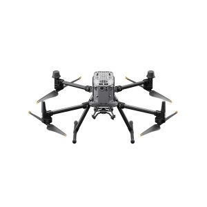
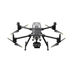
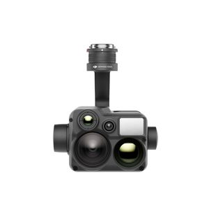
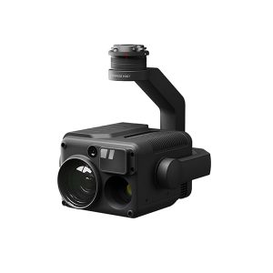
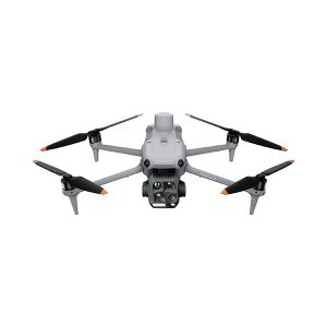
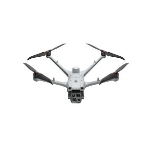
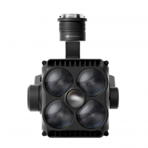
Search and rescue drones offer speed and accuracy that are essential in emergency operations. Aermatica3D solutions offer advanced integrations with DJI drones, dedicated kits, and high-precision visible and thermal cameras, fully integrated with software designed for high-performance SAR missions. Thanks to the “Control Center” function, a single operator can manage multiple pilots and payloads in real time, coordinating simultaneous interventions with maximum efficiency. 

For critical scenarios covered by ENAC regulations, Aermatica3D has also developed DJI-approved Flight Termination Systems (FTS), which guarantee flight termination in emergency conditions without modifying the characteristics of the drone or interfering with the on-board systems.

Fires and Natural Disasters

ricerca e soccorso - vigili del fuoco matrice 4
  • Immediate analysis of the situation thanks to low-altitude flights that provide a quick and detailed view of the area of intervention.
  • Precise identification of critical areas using thermal data and thermal imaging cameras, which are also useful in the presence of smoke, dust, or poor visibility.
  • Support for team coordination with real-time monitoring of operations and assessment of needs in the field.
  • Effective management of fires, avalanches, and earthquakes, quickly identifying priority areas and avoiding the dispersion of resources.
droni ricerca e soccorso - materiali pericolosi
droni ricerca e soccorso - vigili del fuoco
droni ricerca e soccorso - vigili fuoco drone dji

high-altitude rescue

droni ricerca e soccorso - ghiacciai soccorso
  • Geological monitoring of slopes and landslides in areas that are difficult to access, with detailed analysis of slope movements for the prevention of hydrogeological risk.
  • Search and rescue in mountainous environments thanks to high-resolution thermal cameras capable of locating missing persons even in conditions of poor visibility, smoke, or snow.
  • Support for critical operations such as controlled explosions, landslide management, and avalanche control, ensuring safe, real-time monitoring.
  • Logistical air transport with DJI Agras T100, to deliver materials, equipment, and urgent cargo at high altitudes, reducing time, effort, and ground operations in inaccessible areas.
More informations
droni ricerca e soccorso -agras t100 lifting
ricerca e soccorso - aiuto in quota
droni ricerca e soccorso - matrice 4t

Public security

droni ricerca e soccorso - pubblica sicurezza controllo
  • Territorial control with continuous monitoring of sensitive areas thanks to high-resolution video cameras capable of quickly identifying potential critical issues.
  • Reconstruction of road accidents with drones sent to the scene in a matter of minutes to acquire accurate data and reduce response times.
  • Inspection of industrial sites using advanced tracking systems capable of keeping the target in motion and supporting complex operations.
  • Verification of public works such as railways, bridges, tunnels, dams, waterways, and oil pipelines, contributing to environmental risk prevention and improved public safety.
droni ricerca e soccorso - sicurezza pubblica
droni ricerca e soccorso - operatore sicurezza
droni ricerca e soccorso - polizia

Faq

Drones enable missing or injured persons to be located very quickly, covering large areas in just a few minutes. Thanks to thermal sensors, optical zoom, and real-time transmission, they provide an immediate assessment of the situation, supporting critical decisions.
Rescue teams use professional drones equipped with thermal cameras, high-resolution zoom lenses, loudspeakers, searchlights, and BVLOS operation systems. Aermatica3D integrates DJI Enterprise solutions, specialized payloads, and customized configurations for each operational unit.
Drones are used in search and rescue operations, forest fires, road accidents, landslides, floods, structural collapses, operations in inaccessible areas, and real-time monitoring of critical events. They are indispensable when access by land is difficult or dangerous.
Thermal cameras detect heat emissions through darkness, smoke, vegetation, or debris, facilitating the detection of people, active fires, or hot spots during a fire. They provide immediate data that is visible even from a distance via live streaming.
Yes, if properly equipped. Professional drones have auxiliary lights, thermal cameras, low-light sensors, and stabilization systems. However, operations must comply with regulations and the suitability of the vehicle for weather conditions.
Drones transmit images in real time via dedicated links, 4G/5G networks, or tethered systems. Streams can be viewed by the operations center, the team on site, and integrated into GIS platforms or mission maps.
Aermatica3D offers turnkey solutions: drone configuration for critical scenarios, customized payloads, tethered systems for continuous flights, operator training, regulatory support, and integration with special vehicle
Aermatica Logo Talk to an expert
Logo_aermatica3d - dimensioni grandi
Drone solutions provider 
Integration of application solutions for drones 
CONTACTS USPRIVACY POLICYCOOKIES POLICY
BVCER_withAccredia-ISO 9001
CONTACT
Via Tettamanti 1 - Colverde (CO) 22041 - Italy
info@aermatica.com
+39 031 552070
P.IVA -IT03630610131
TERMS AND CONDITIONSPURCHASE TERMS AND CONDITIONS 
cartchevron-down linkedin facebook pinterest youtube rss twitter instagram facebook-blank rss-blank linkedin-blank pinterest youtube twitter instagram