Logo_aermatica3d - dimensioni grandi
AERMATICA - INTEGRAZIONE DI SOLUZIONI APPLICATIVE PER DRONI - IMG LINGUA INGLESE
Logo_aermatica3d - dimensioni grandi
Shop
AERMATICA - INTEGRAZIONE DI SOLUZIONI APPLICATIVE PER DRONI - IMG LINGUA INGLESE

Drones for agriculture

Integrated solutions for drones in farming

Aermatica3D is an official DJI Agriculture dealer and system integrator for professional precision agriculture solutions using drones.
Precision agriculture is made possible by drones equipped with visible, multispectral, and thermal sensors, which enable rapid aerial surveys and the generation of crop status maps for agronomic decisions based on real data.

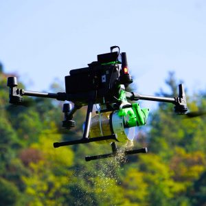
In addition to monitoring solutions, DJI Agriculture drones allow for targeted and environmentally friendly aerial distribution of liquid, granular, powder, or capsule products, intervening only in areas that need it.

Thanks to automatic flights that can be programmed via an app, surveys and treatments are accurate, repeatable, and economical, promoting sustainable and environmentally friendly agriculture.

Agricultural drones for product distribution

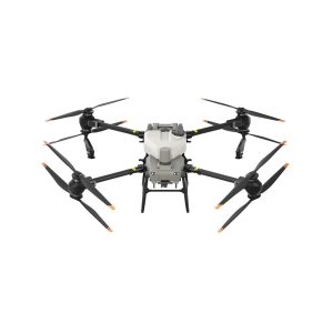
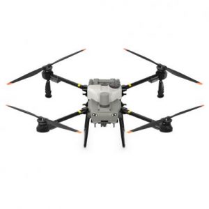
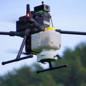
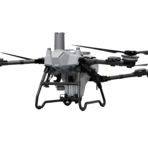
Agricultural drones allow for the precise distribution of liquid products such as fertilizers and biostimulants, as well as granules, on crops of any size, optimizing time, costs, and resources.
drone per agricoltura - t100 spraying

What can be managed:

  • Uniform dosing and distribution of liquids and granules
  • Reduced product use thanks to targeted distribution
  • Rapid treatment of large or difficult-to-access areas
  • Greater operator safety and treatment speed

Drones in agriculture enable targeted and customized interventions, improving agricultural production and increasing crop efficiency.

droni per agricoltura - distribuzione granulare
DJI AGRICULTURE - dji-agras-t50-de_17.webp - resize

Aermatica3D kit for organic farming

Aermatica3D kits offer advanced solutions for organic and precision farming, using drones to distribute pollen, capsules containing beneficial insect eggs, live beneficial insects, and seed balls for reforestation, as well as other biological agents. These technologies promote sustainable crop management, improving biodiversity and reducing the use of chemicals.
DRONI AGRICOLTURA - kit d-box AE3D

What can be managed:

  • Precise distribution of pollen for assisted pollination
  • Targeted release of beneficial insects and capsules for biological pest control and seed balls for reforestation
  • Rapid application over large areas, reducing soil disturbance
  • Flight monitoring and planning via the BLY5D app

Biological distribution with drones reduces costs, increases productivity, and ensures healthy, high-quality crops while fully respecting the environment.

DRONI PER AGRICOLTURA - KIT 1 AE3D
DRONI PER AGRICOLTURA - KIT 2 AE3D

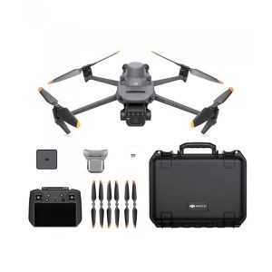
Multispectral mapping and surveys

With DJI drones, it is possible to perform 2D/3D surveys and obtain high-precision multispectral maps to assess the health of crops and the surrounding environment, as well as soil moisture, in real time.

What can be analyzed:

  • Vegetative vigor and crop health monitoring
  • Soil moisture and water stress levels
  • The spread of weeds in plantations
  • Land configuration and building mapping

This technology allows the creation of variable rate distribution maps which, once entered into agricultural drones, enable a reduction in the use of products and optimization of the harvest.

droni agricoltura - dji agricolture - dji 3m rilievi drone v.2
droni agricoltura - rilievi v.2

Faq

Currently, Italian legislation allows for the distribution of all products that are not classified as prohibited for distribution by air.
It depends on the application scenario. Normally, to obtain authorization to fly this type of aircraft, you need to obtain an A1/A3 license, an A2 license, and SPECIFIC category licenses such as STS-01 and SORA.
Yes, but only with specific exemption (in Italy).
It depends on various environmental factors, but we have found that it is possible to cover more than 50 hectares per day.
Agricultural drones can be piloted either manually or by creating a flight plan that allows them to be used in automatic mode.
Information on plant vigor, water stress, soil moisture, weed spread, and soil structure. Indices such as NDVI, NDRE, GNDVI, LCI, and OSAVI are also obtained.
The accuracy of mapping with an RTK module is centimeter-level, but may vary depending on the sensor and flight planning.
Aermatica Logo Talk to an expert
Logo_aermatica3d - dimensioni grandi
Drone solutions provider 
Integration of application solutions for drones 
CONTACTS USPRIVACY POLICYCOOKIES POLICY
BVCER_withAccredia-ISO 9001
CONTACT
Via Tettamanti 1 - Colverde (CO) 22041 - Italy
info@aermatica.com
+39 031 552070
P.IVA -IT03630610131
TERMS AND CONDITIONSPURCHASE TERMS AND CONDITIONS 
cartchevron-down linkedin facebook pinterest youtube rss twitter instagram facebook-blank rss-blank linkedin-blank pinterest youtube twitter instagram