
We look forward to seeing you on Tuesday May 9 at 4.30 pm at the CIHEAM - Mediterranean Agronomic Institute of Bari Via Ceglie 9, 70010 Valenzano (BA) - Italy for our demo on drones in precision agriculture where we will present the drone for distributing liquids and solid DJI Agras T10 and the drone for multispectral surveys DJI Mavic 3 Multispectral, ready for delivery at Aermatica3D.
This event is free of charge, registration is required by Monday May 8th, 3PM.
Effective aerial surveying needs to see the invisible. That's why Mavic 3 Multispectral has two forms of sight. It combines an RGB camera with a multispectral camera to scan and analyze crop growth with total clarity.
A capacity of 8kg and spreading width of up to 7 meters support an hourly productivity of 14 acres. It also supports real-time weight monitoring and has an anti-rotation sensor, allowing more accurate refill alerts.
This saturday, April 29th Aermatica3D will participate to the conference "Technologies and Techniques for Sustainable Agriculture " at Navarra Foundation for Agriculture with AgriGeoDron for a field demonstration which will present our drones solution for Agriculture.
We look forward to seeing you!
 Navarra Foundation, Via Provinciale 15/B, Gualdo di Voghiera (FE)
 Saturday, April 29th, 11:00 a.m.
The integrated systems for drones represent the real added value of Aermatica3D, the research and development department does not limit itself to creating customized drones, but based on the specific requirements of each customer it is able to develop and integrate kits, cameras and sensors, allowing to have a single integrated remote-sensing system for remote control of the instrument, real-time data display and management on the ground, thus obtaining a safe, complete and reliable product.
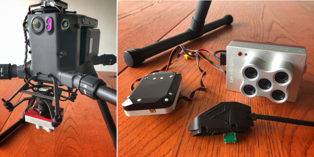
Today we worked on the integration of a five-band Micasense Rededge MX multispectral camera on the DJI Matrice 300 drone. The Micasense Rededge MX camera is equipped with a multispectral sensor, suitable for agricultural use to monitor crop growth, areas of land that require more water, fertilizers, or other types of treatments. This camera can produce infrared calibrated images to collect vital data about crop growth.
Our integration consists in two parts:
1. Multispectral camera integration
2. DLS2 sensor integration
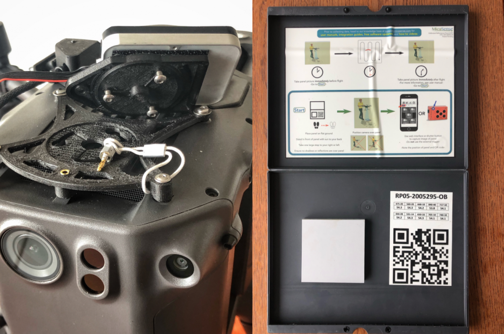
We used the SkyPort port to mount the camera, while for the DLS2 sensor, we used a quick connector that allows for fast mounting in seconds. The integration is powered via the upper USB port through a key that powers the camera and the light sensor. The stand-alone system works through the proprietary Micasense app. The integration can be used on Matrice 300 or any other DJI Matrices. A reflectance plate is also supplied with the camera which allows the camera to set the optimal parameters according to the light of the day in which the survey is performed.
Thanks to its know-how in the field of engineering and to the cooperation with official partners from international realities, Aermatica3D can offer the best custom solutions for any drone integration.
To find out more about our integration solutions contact us
Aermatica3D is very pleased to become official reseller of remote sensing systems for Headwall, in Italy. Founded in 2003, Headwall is a global leader with facilities and partners around the world, providing spectral solutions for commercial users with critical, application needs.
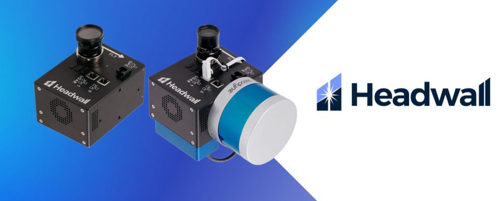
Headwall focuses on the acquisition and exploitation of reflected light for commercial and government customers working in remote sensing, industrial machine vision, and their own OEM instrumentation markets. The Company provides:
Integrated hyperspectral imaging solutions
Spectral imaging sensors
Raman imaging spectrographs and OEM subassemblies
Diffraction gratings and optical modules for OEM customers
Headwall's hyperspectral imaging sensors are used aboard a variety of UAS platforms, including models by DJI Enterprise and FreeFly. Headwall professionally integrates and tests every airborne package it sells. This includes putting the package through a range of data-collection and data processing exercises to assure the highest performance and most reliable operation.
High-spectral-resolution sensors represent a game changer, since they can spot crop stress before symptoms become visible to the naked eye. Phenotyping benefits from increased the increased precision these sensors offer.
Lightweight Commercial Off-The-Shelf (COTS) sensors or subassemblies for use aboard small satellites or even constellations of Low-Earth-Orbit (LEO) satellites enable high-performance imaging with low risk.
Data fusion using hyperspectral and 3D LiDAR data can enable increased operational efficiency, as well as important safety benefits.
Even subtle changes over time can be detected. Capture imaging data even from difficult-to-access areas using portable drone systems with rugged payloads containing powerful sensors suited to the task.
Hyperspectral-and-LiDAR drone payloads offer convenient deployment and accurate classification of minerals from the air or in the field made possible using spectral regions most appropriate for the task from UV to VNIR to NIR to SWIR.
Bridges, dams, railways, pipelines, and even asphalt on busy airport runways need to be inspected. Drone-based hyperspectral imaging collects data over the spectral range you need in order to identify signs of corrosion or leaks while reducing risk to personnel.
Learn more about Headwall remote sensing systems here
by Andrea De Tommasi
“From low-tech irrigation methods to precision agriculture and agricultural drones, emerging agricultural technology is generating efficiency gains, boosting production and creating new jobs,” the World Economic Forum wrote in its recent “Markets of tomorrow report 2023”. The WEF asked managers from 120 countries which technologies will prove to be strategically more important in the next decade: agricultural technologies ranked first, followed by those for education and workforce development, and those for storage and the generation of energy.
A research published a few days ago by the Smart Agrifood Observatory of the Milan Polytechnic found that the agriculture market 4.0, with its connected machinery and remote monitoring systems for crops and land, in Italy in 2022 made a step forward, surpassing the 2 billion euro wall (2.1) and growing by a third compared to the previous year. An increase that took place in a difficult scenario, between the increase in the cost of raw materials and the crisis linked to the great drought.
Encouraging data for a sector that runs in other countries (see the United States and Australia), but is starting to have a significant impact here too, despite the fact that there is still space for development: it is estimated that only about 10,000 farms in Italy , out of a total of 1 million and 100 thousand, use systems related to agriculture 4.0. The level of diffusion, among other things, varies according to the specific technology and the geographical area in which they are used.
Some of these technologies are spreading quite rapidly, such as the use of sensors to collect data on crops and the surrounding land, the automation of agricultural activities such as planting and harvesting, and the use of drones for crop mapping and monitoring.
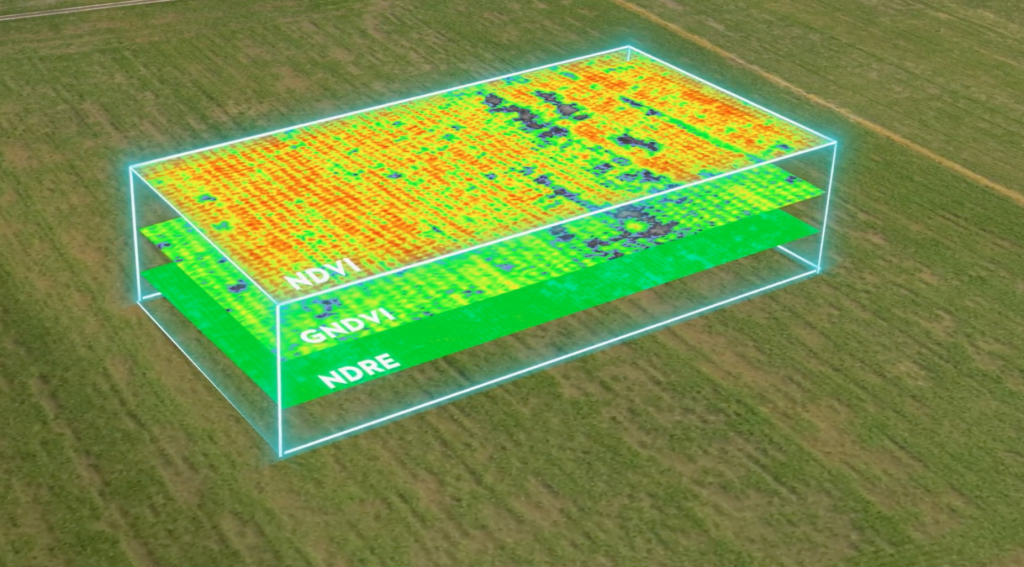
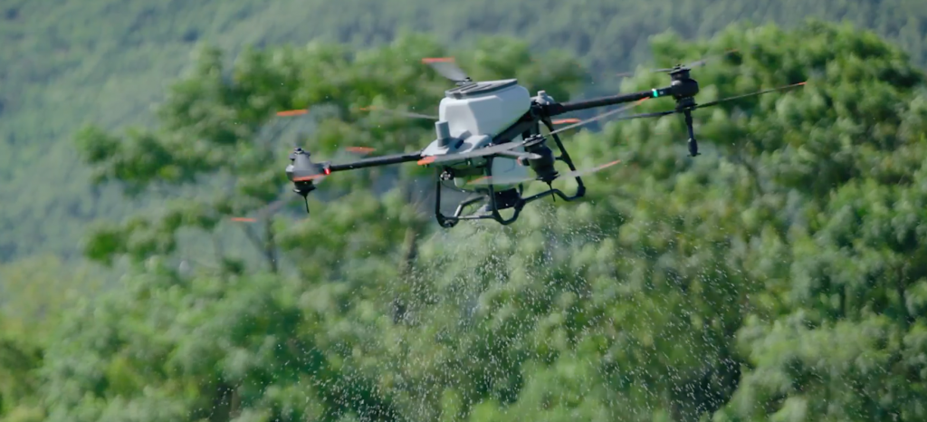
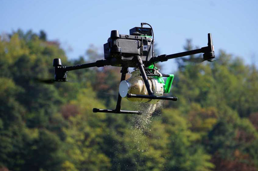
Another mature technology that is gaining increasing importance in the agricultural sector from a green perspective is that of drones. Aermatica3D is an Italian company specialized in drones for precision agriculture. "For the precision distribution of liquids, granulates, powders and capsules our drones fly at a height of 1.5-3 meters", explains Paolo Marras, General Manager of the company, "they can also carry out surveys in a field and collect useful data for making decisions on the strategies to be adopted. The advantages are the relative ease of application, the high precision which means that less product is used and it acts directly on the crop, the possibility of reaching dangerous areas for humans, just think of the hillside vineyards, and last but not least labor savings. All at a competitive cost, much lower, for example, than operating with a tractor”.
Aermatica3D follows farmers by providing DJI Academy certified drone pilot courses, support and DJI Agras certified maintenance. The insect distribution kit solutions useful for biological control and assisted pollination by Aermatica3D are also in great demand abroad, for example in Chile and Malaysia. “In Italy, knowledge of precision agriculture is still in its beginning, farmers have a certain distrust of solutions other than those they usually use. The new generations, however, have a much more innovative approach than the previous ones. There is also a great push from the regions through national calls for tenders which are greatly encouraging the purchase of drones".
Read more on FuturaNetwork.eu
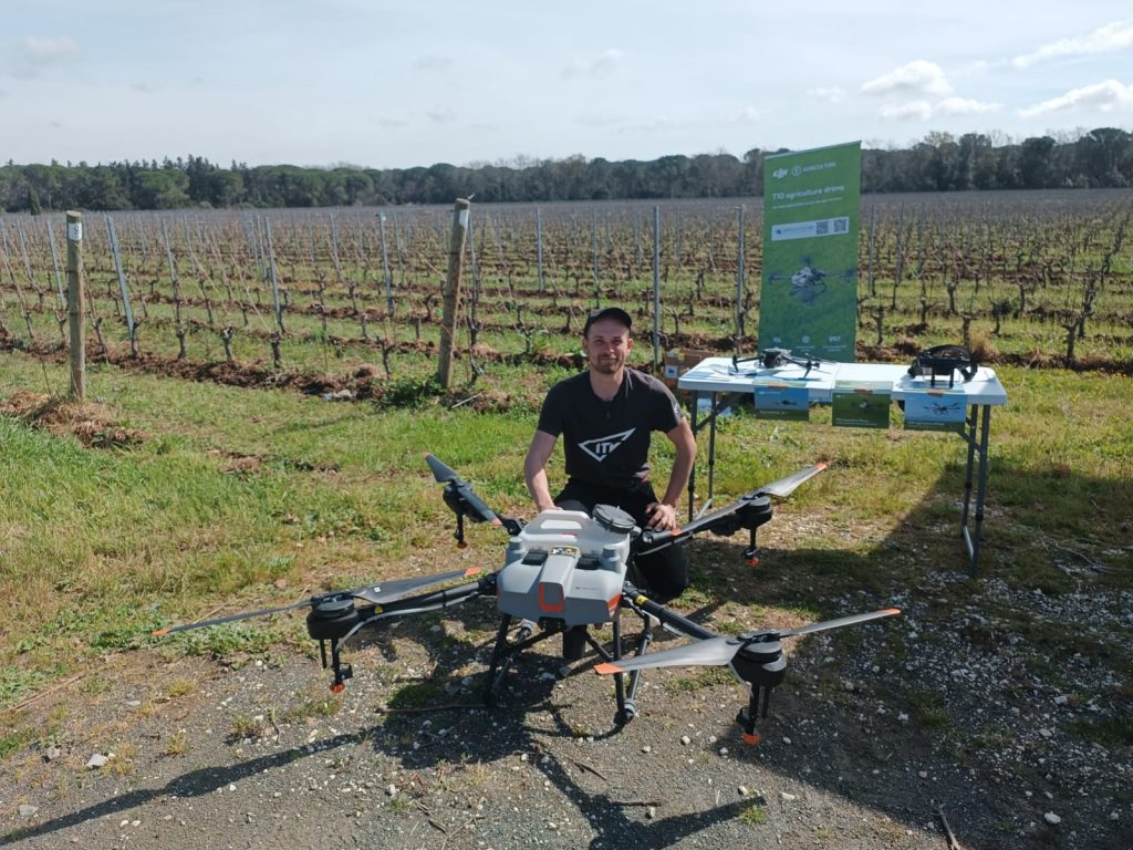
On 22 March 2023 in Castagneto Carducci, Aermatica3D participated to the event on viticulture and oenology organized by Terre d'Etruria soc. coop. Agricola "Sangue della Terra". The event gave us the opportunity to present DJI's drones for precision agriculture, specifically the DJI Agras T10 and the DJI Enterprise Mavic 3 Multispectral.
This third edition of "Sangue della Terra" had as its theme "CLIMATE CRISIS: EFFECTS ON VINES, ADVERSITIES and VINIFICATION. ". The effects that climate change is having and will have on the cultivation of vines in the near future and the quantitative-qualitative production of wines, in particular those from Tuscany, were studied in detail.
Nowadays, operators in the agricultural and agri-food sector are fully aware of the great the impact of global warming on the crops production. Also the Italian wine sector in recent years has experienced first-hand the effects of extreme climatic events (spring frosts, long periods of drought, increase in average annual temperatures in particular in summer), on the physiology of the vine and the balance of viticultural agroecosystems.
The event had the objective of bringing together some of the most representative experts in the fields of climatology, agronomy, technological and digital solutions as well as oenology to collect the technical solutions and agronomic technologies useful to mitigate the negative effects of the current climatic trend on the cultivation of the vine.
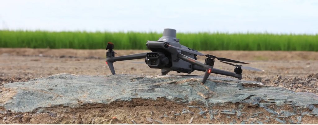
At the event, Aermatica3D had the opportunity to showcase the drones DJI Agras T10 and DJI Enterprise Mavic 3 Multispectral, a new technology that is crucial now in precision agriculture, helping farmers saving resources and time when treating coltures. The DJI Agras T10 can be used for the distribution of liquids and solids, has a capacity of 10 kg and a distribution width of up to 7 meters. In addition, DJI Agras T10 supports an hourly productivity of 14 acres. The DJI Enterprise Mavic 3 Multispectral is a multispectral survey drone, a solution designed for individual companies and organizations operating in precision agriculture for the acquisition of detailed information on crops. This version of DJI Mavic 3 is equipped with a multispectral imaging system capable of acquiring crop growth data with incredible speed and accuracy, allowing you to increase the efficiency of agricultural productivity. The DJI Mavic 3 Multispectral is an indispensable solution for a wide range of application scenarios related to precision agriculture and environmental monitoring.
We want to thank once again Terre d’Etruria Soc. Coop. Agricola and Tenuta Ornellaia for the organization of the event.
Aermatica3D is an Italian drone solution provider that integrates different flight platforms, sensors, software, and hardware components, to meet the specific needs of companies, research centers, government bodies, and professionals. For each specific application need, they select the most suitable drones, sensors and develop specific planning, management, and mission software. The company carries out customized engineering developments, completing safe and reliable flight platforms operated according to the application needs of the customer and ENAC authorizations.
Based on the specific needs of the customer, Aermatica3D can offer a turnkey service, operating in the field with their pilots and specialized technicians, or an integrated product with the appropriate technologies, accompanied by the training necessary for the application use, which allows the customer to use the system independently.
Aermatica3D is also DJI Enterprise and DJI Agriculture Official Dealer and System Integrator, DJI Agriculture Maintenance Center and DJI Academy Center. DJI is the world manufacturer of drones, able to guarantee at the same time an excellent quality – price ratio with high reliability. Aermatica3D develops applications on top of DJI drones thanks to the DJI SDKs and its wide range of platforms suitable for every need, easily adaptable, and extensible.
Aermatica3D is a partner of CUBEPILOT, a world leader in Pixhawk open-source systems for the automatic piloting of UAS SAPR technologies, and Elistair, an international manufacturer of tethered systems for drones.
Interview with Maddalena Di Tommaso, Sales and Marketing Specialist at Aermatica3D.
Easy Engineering: What are the main areas of activity of the company?
Maddalena Di Tommaso: Main areas of our activity are solutions for Industrial, Safety and Agricultural application of our drones related technology.
Solution for Industries
Among the many companies that benefit most from the solutions proposed by Aermatica3D are energy companies, manufacturing industries, professional firms, and engineering companies interested in optimizing productivity, data management, and personnel safety.
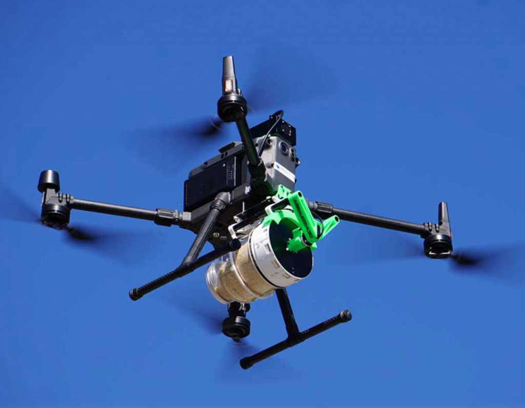
Safety, reliability, and efficiency are essential characteristics for the industrial sector, the primary beneficiary of the technological innovations introduced by drones and their operational solutions able to offer valuable integrations in the processes of industry 4.0.
The solutions provided by drones can return visual, radiometric, thermal, and environmental data helpful in carrying out an innumerable number of operations in industrial plants, power plants, construction sites, and the built environment.
The software integration capabilities into business processes, support, technical assistance, maintenance, and the fulfillment of personal requirements make Aermatica3D the ideal partner for many industrial players.
Solutions for Agriculture
The Aermatica3D Drones for Agriculture are precision aerial surveying instruments for precision agriculture, equipped with visible, multispectral and thermal sensors that provide quickly and easily crop status maps.
The Aermatica3D drones for agriculture are also tools for targeted low-cost, ecological and economical air distribution of products. It is possible to distribute from the low altitude above ground in an automatic and precise way, liquid products, granules, powders and capsules; the drone can import a map and quickly and effectively distribute the products exclusively in the areas that need them and in the appropriate quantity.
Through automatic flights, programmed simply through the APP BLY3D of Aermatica3D, you can make quick surveys and distribution of products optimized in a repeatable and economic way, without polluting for a bio sustainable agriculture in respect of the environment.
Solutions for Security
With Aermatica3D’s integrations to support companies and government bodies, it is possible to use security drones perfectly integrated into alarm and video surveillance systems, capable of obtaining an immediate overview of the site, managing every aspect of the flight in a safe, complete, and efficient way.
Drones can be used as a deterrent to the entry of sensitive or dangerous sites, detect potential intruders, or assist with investigations, thus improving the efficiency of inspections and sending assistance to inquiries feedback in real-time, directly to the total security control center.
These solutions also make it possible to patrol large areas, provide complete coverage, carry out fully automatic flights at pre-established times, and carry out missions activated by external alarms and sensors.
In addition, we develop integrated solutions for drones in the field of Search and Rescue. Timeliness and accuracy are fundamental requirements in case of emergencies. The solutions and integrations offered by Aermatica3D can bring significant benefits in search and rescue, guaranteeing simplified, reliable, and high-performance missions.
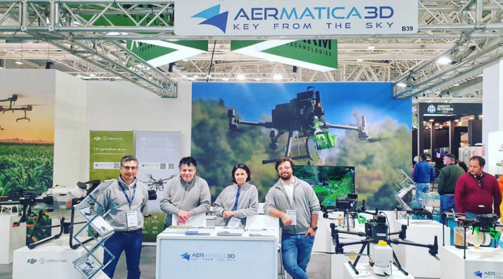
Aermatica3D’s solutions include specific kits and high-precision visible and thermal cameras perfectly integrated into the BLY3D app, a fully customizable software with features specifically designed for search and rescue operations.
With the “control center” function, it is possible, for example, to employ multiple pilots in different areas having a single expert able to control each payload directly from his control center, communicate with the pilots on the ground, and show the position pointed by the camera in real-time thus ensuring maximum speed, accuracy, and efficiency at each intervention.
E.E: What’s the news about new products?
M.D.T: In the applications of Drones in Specific scenarios with safety issues, to further extend the usage scenarios, Aermatica3D has also developed, flight terminator – FTS (flight termination system), a safety device that ends the flight in case of system problems – which enables the critical scenarios issues required by EASA (the European Aviation Safety Agency) without altering the design characteristics of the drone and without interfering with the drone on-board systems.
Aermatica3D drones for agriculture instead, are also means for the targeted, ecological and economic aerial distribution of products from low altitude. It is possible to distribute liquid products, granules, powders and capsules automatically and precisely from low altitude. The drone can import a map and quickly and effectively distribute the products exclusively in the areas that need them and in the right quantity. We develop applications for drones that allow the distribution of environmental treatments in inaccessible or large areas, such as: distribution of liquids on complex scenarios, product distribution, distribution of beneficial insects drone pollination and more. Aermatica3D biological control kits have been awarded at two editions of the Technical Innovation Context at EIMA one of the most important fair in Europe related to Agriculture Mechanizations. Those solutions can be an enabling factor to aid the development of wide application of Biological Control Tecnique.
E.E: What are the ranges of products?
M.D.T: The range of products of Aermatica3D varies from drones integration of different flight platforms, sensors, software, and hardware components, to meet the specific needs of companies, research centers, government bodies, and professionals, making a drone an ideal tool for several advanced application tasks
E.E: At what stage is the market where you are currently active?
M.D.T: Aermatica3D is well placed on Italian the drone solution market, especially in the field of Agriculture, Industry and Search and Rescue. The company is planning for a stronger internationalization process to enhance the already existing cooperation and presence with projects that cover Chile, Greece, Spain France and more.
E.E: What can you tell us about market trends?
M.D.T: The agriculture drones market share is expected to witness notable growth until 2030, owing to rise in venture funding for deployment of drones in the agriculture industry, globally. Furthermore, surge in adoption of precision farming solutions drives growth of the market during the forecast period. Moreover, surge in demand for a reduction in cost associated with human error is expected to propel the agriculture drones market analysis.
E.E: What are the most innovative products marketed?
M.D.T: One of our solutions in line with the objectives of the UN 2030 Agenda for Sustainable Development and sees the collaboration between Aermatica3D and Koppert, a world leader in the supply of biological solutions for agriculture. This synergy led to the development of an innovative specific kit for the distribution of useful organisms which had already received the Technical Innovation award at the Eima 2018 competition – the international reference event for agricultural mechanization in Italy – and the now finalized kit has confirmed its effectiveness also receiving the same award at the Eima 2022 competition.
The current application technique is based on the preventive release of the predator on the perimeter of the field as soon as the conditions favor the development of the pathogen. The phytoseiid mite is thus able to settle in the crop and keep it clean by preying on the phytophagous. For precision distribution, the drone has a precise mapping to follow, it flies at a height of 4-5 meters and the predatory mites, placed in a tank together with a substrate of sawdust, are dispersed like a fan. When the tank runs out or the battery runs out, the drone returns to the starting point, refuels and picks up from where it left off. Once the logistic is being set (getting organized with qualified pilots and suitable tools, mapping the field, providing coordinates and product) the advantages are enormous: great speed of application, even more than 100 hectares a day; high precision and uniformity of distribution; all at a decidedly competitive cost”.
E.E: What estimations do you have for 2023?
M.D.T: Our plan in 2023 is to penetrate foreign markets with focus on our drones solutions in the field of agriculture and of course, keep going with innovation and technology researches and applications.
Coming from a family of farmers and breeders, Michel Clusaz, agricultural entrepreneur, started working in the mountain pastures at a very young age and then diversified his business into various agricultural sectors and services. The passion for viticulture was handed down to him by his mother and directed him towards university studies in agriculture and oenology. Currently, Michel Clusaz manages about 4 hectares of vineyards in addition to 30 hectares of meadows, pastures, orchards as well as about 70 cattles. Today we asked him about his experience using DJI Agras T10 drones in his vineyards.
Michel, when did you start using drones?
I started using drones on my vineyards and some orchards only recently, in 2022, with the purchase of a first DJI Agras T10 from Paolo Marras, of Aermatica3D. As of 2021, only one other farmer in our area had made such innovation in the area, making us pioneers in testing this new technology in Val D'Aosta.
How did you come to know drones in agriculture?
I am very interested in innovation in general and especially in agriculture. I regularly keep myself up to date about new technologies in agriculture. I participate in trade fairs and follow innovation in agriculture on social media. In the drone sector, I started following the evolution of their applications in the agricultural field 4-5 years ago. In 2019 in Arnad, in the Kiuva cooperative headquarters, there was a field test of the model preceding the DJI Agras T10, the MG1P, with the company Getto s.n.c. and with Paolo Marras of Aermatica3D. There I understood the feasibility of using the vehicle on my vineyards and convinced myself to buy it.
Why did you decide to switch from traditional methods to using a drone in your vineyards?
The main reason was to solve a problem of increased work as a result of managing a larger area in my vineyards. I definitely needed help with taking care of the vineyards, but hiring workers was precluded due to high costs of workforce in the sector and the complexity of the organization. Therefore, I opted for mechanization, which is also my personal passion.
Did you use the drone immediately after purchase?
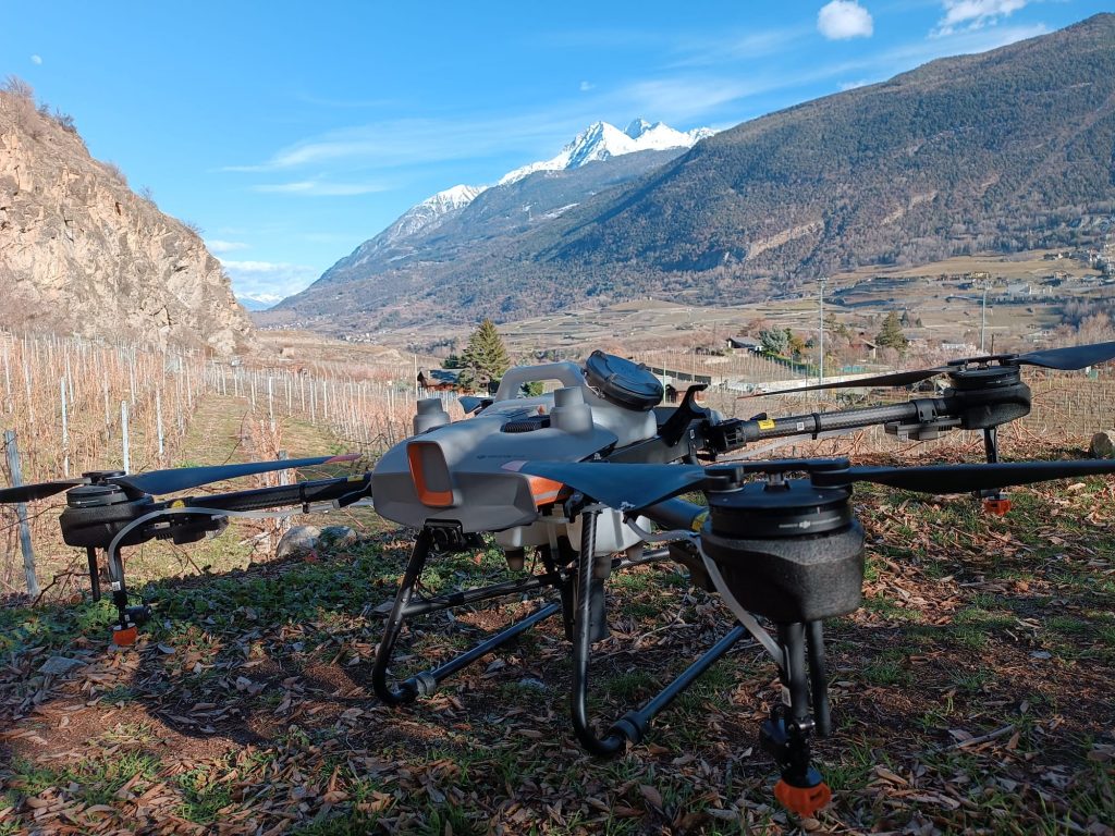
As soon as the DJI Agras T10 drone arrived, I immediately set it up and used it to learn how to fly it at its best. At first I was worried, it was a vehicle I had never tried, I had never even tried to fly radio controlled helicopters as a child! Over the course of a month, we took part in a demonstration in Alba, with a first try of foliar fertilization in April 2021. From then on I used the DJI Agras T10 regularly, and I still use it up to now. I also decided later to purchase another one which has just arrived at the end of this January 2023.
Where did you use it and with what benefits?
I started on an orchard and vineyards. My vineyards are located in the mountains on a steep slope, where the only usable means was the backpack sprayer. The sprayer loads 15 liters of product and spreads as you walk through the vineyards. It takes four days of work, a monstrous expenditure of energy. This process got me so exhausted that I it was hard to make it until the end of the day.
With the drone, health is the main benefit. Now I can treat steep slopes with foliar fertilizers very easily, I have considerably reduced my working hours. In one morning I can finish the job I used to do in four days without having to carry any weight.
Moreover, there is no need for being close to the vineyards, therefore no longer the need of using masks and coveralls to use foliar fertilizers, which despite being natural are not healthy for the body. I can now work in office clothes, which is a quite unusual thing for a farmer.
Another very important aspect compared to the use of a tractor sprayer is the drift effect, which is very reduced with the drone, meaning that the product distributed is more localized than with the distribution done with a tractor. With the drone you can have a drift effect of 1.5m in the absence of wind, which with the tractor can reach up to 10-20 meters.
One last question that all farmers probably ask before thinking to purchase a drone for agricultural use, especially in the case of the DJI Agras T10 which is not so small. Is it complicated to fly?
Absolutely not, it's actually very simple to use. I carefully plan my route and hit the start button, and it basically flies on its own!
Do you also have a vineyard and are interested in learning more about the use of drones in agriculture?
Innovation is the key to meeting the challenges of our time. The growing demand for food and climate change require new solutions to ensure the sustainability of agriculture and food production. One of the most promising innovations in agriculture is drone-assisted pollination, which can improve the yield of Italy's olive groves and respond to the growing demand for high-quality olive oil.
The importance of pollination for olive groves
The olive tree is a dioecious plant, which means it has male and female flowers on separate plants. Fertilization occurs when pollen produced by male flowers is carried by winds or insects to females. Pollination is an essential process for producing high quality fruit and seeds. Furthermore, it is important for the conservation of biodiversity, as it promotes the genetic diversity of plants.
However, the quantity and quality of pollination can be influenced by several factors, including climate, the presence of pollinating insects and soil quality. Furthermore, the use of pesticides and the destruction of the natural habitats of pollinating insects can reduce the insect population, leading to a reduction in natural pollination.
Drone assisted pollination
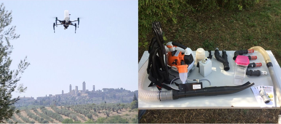
Drone Assisted Pollination is an innovative solution that uses drones to transport pollen from male flowers to female flowers. This method can be used to increase the quantity and quality of pollination in olive groves, improving the yield and quality of the olive oil.
The drones used for assisted pollination are equipped with a device that distributes the pollen on the female flowers. The pollen used was previously collected from the male flowers and stored in the refrigerator until needed. In this way, the quality of the pollen can be guaranteed and the chances of fertilization increased.
Benefits of drone assisted pollination
Drone assisted pollination has several advantages over natural pollination. First, drones can reach areas that are difficult for pollinating insects to reach, such as treetops or remote areas of olive groves. Secondly, assisted pollination can be timed for the best time, ensuring that fertilization takes place when conditions are optimal. Finally, assisted pollination can also be used in the event of a reduction in the population of pollinating insects, such as due to the use of pesticides or the destruction of natural habitats.
Last year, Aermatica3D joined the Olimpolli Montagnani Operational Group (financed with measure 16 of the 2014-2020 Rural Development Plan of the Tuscany Region) together with the CAICT SRL Business Assistance Center Coldiretti Toscana, the CNR IBE Institute for the Bioeconomy, the Department of Life Sciences (DSV) of the University of Siena, the Center for Generative Communication of the University of Florence and various agricultural companies have worked together to solve the problem of poor pollination of the olive tree, which affects the overall productivity of the olive groves , verifying from a practical point of view the effect of pollen dispersion on fruit setting and profitability per hectare.
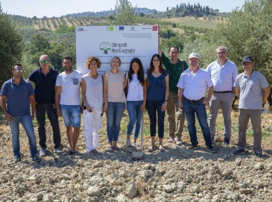
In fact, the Operational Group set out to increase the productivity of the olive groves without any change in the corporate structures simply with the controlled contribution, currently identified as ideal, of the best pollen for the variety of interest.
The innovative aspects
The main innovation consists in the distribution of pollen on plants to be carried out by drone at the moment of best receptivity for the stigma. The technique, which has never been applied to olive trees before, is inspired by some tests carried out on other wood species.
A further innovation consists in verifying the various aspects related to the distribution of pollen in olive growing, which will involve the involvement not only of farms but also of some Italian machinery manufacturers. It is estimated that the repercussions on the primary sector are important because a raise in fruit set and consequent productivity estimated at around 20-25% is expected.
The replicability
This technique can affect all Tuscan plants, even the traditional ones, without any significant change in the company structure, not requiring onerous interventions for farms. The project therefore intends to put into operation and test, within some model farms, the system for controlling flowering, distributing pollen on the flowers, verifying fruit setting and the trend of summer and harvest production, analyzing the costs / benefits of this practice.
The results
The research has led to the implementation of an assisted pollination system that can be technically evaluated and economically estimated, an increase in the productivity of traditional olive groves, the development of an innovation transmission network on a regional scale and
The positive evaluation of the use of the drone in olive growing as a tool for pollen dispersion but potentially also for other agronomic purposes related to precision agriculture.
Could assisted pollination be a solution for your olive groves?

Aermatica3D has just been accredited as DJI Academy, becoming the Italian headquarter offering specific training on DJI Agriculture products to become a certified DJI Pilot. The classrooms are located in the green Prealps of Como, easily reachable by own or public transport. We provide a 360-degree onsite theoretical training on the flight planning, practical flight, and product spraying drones. Just behind our offices we have a large field for practical exercises. With more than 5 hectares of surface, the base includes several scenarios: structures, differences in height, trees, crops. These, combined with our instructors’ long experience, guarantee specific and complete training for any type of agricultural application. Como City and its lake is the backdrop to the activities, welcoming the participants with numerous services and attractions, marveling them with its beauty. DJI Agriculture Dealer and Maintenance Center since 2017, Aermatica3D provides technical and educational support to professionals, farmers, companies, and entities who want to implement drones in their businesses.
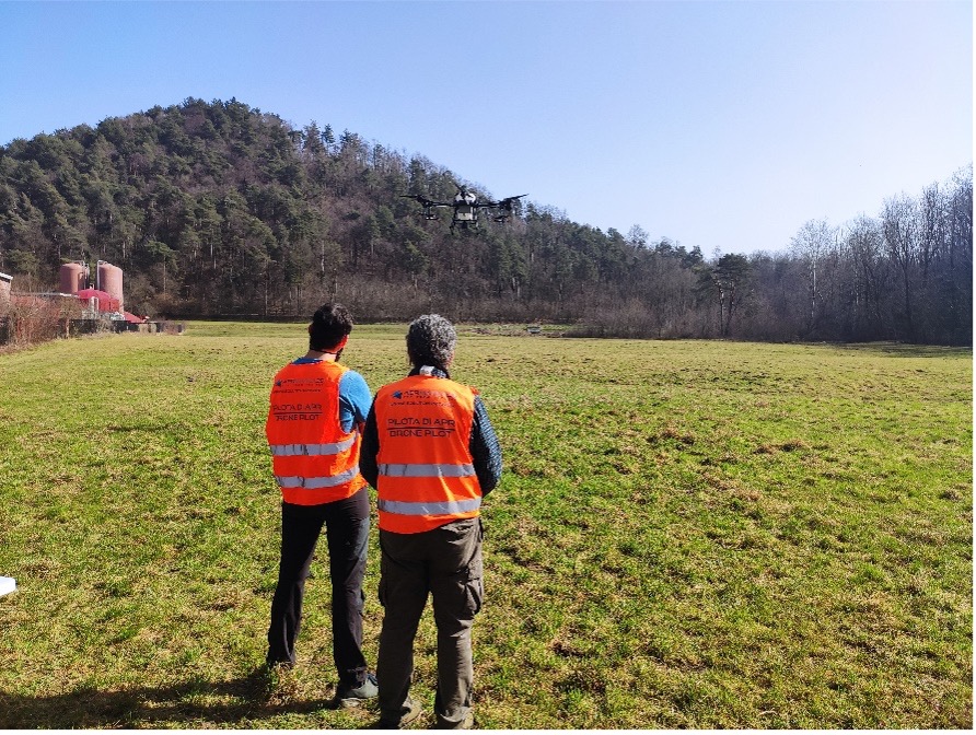
The DJI Academy UTC was born in Italy in 2021 and provides specific theoretical and practical training for DJI drones. In a period in which the European drone regulation provides only for theoretical exams, the DJI Academy supports the drone pilot in the practical and specific preparation for all DJI drones..
Upon passing the final exam, the candidate will obtain the DJI certification valid worldwide. It is one of the most appreciated and recognized drone patents globally. The EASA (European Union Aviation Safety Agency) courses are currently exclusively theoretical and do not provide any practical training.
Through our DJI drone courses you can instead become a professional in the agricultural sector and fly in complete safety. DJI certified drone pilots are 70% less likely to have an accident in flight thanks to the high level of training program. Diversify your CV as a drone pilot and offer your services to high-level customers by obtaining the certification of the DJI Academy of Como in the Aermatica3D headquarters.


